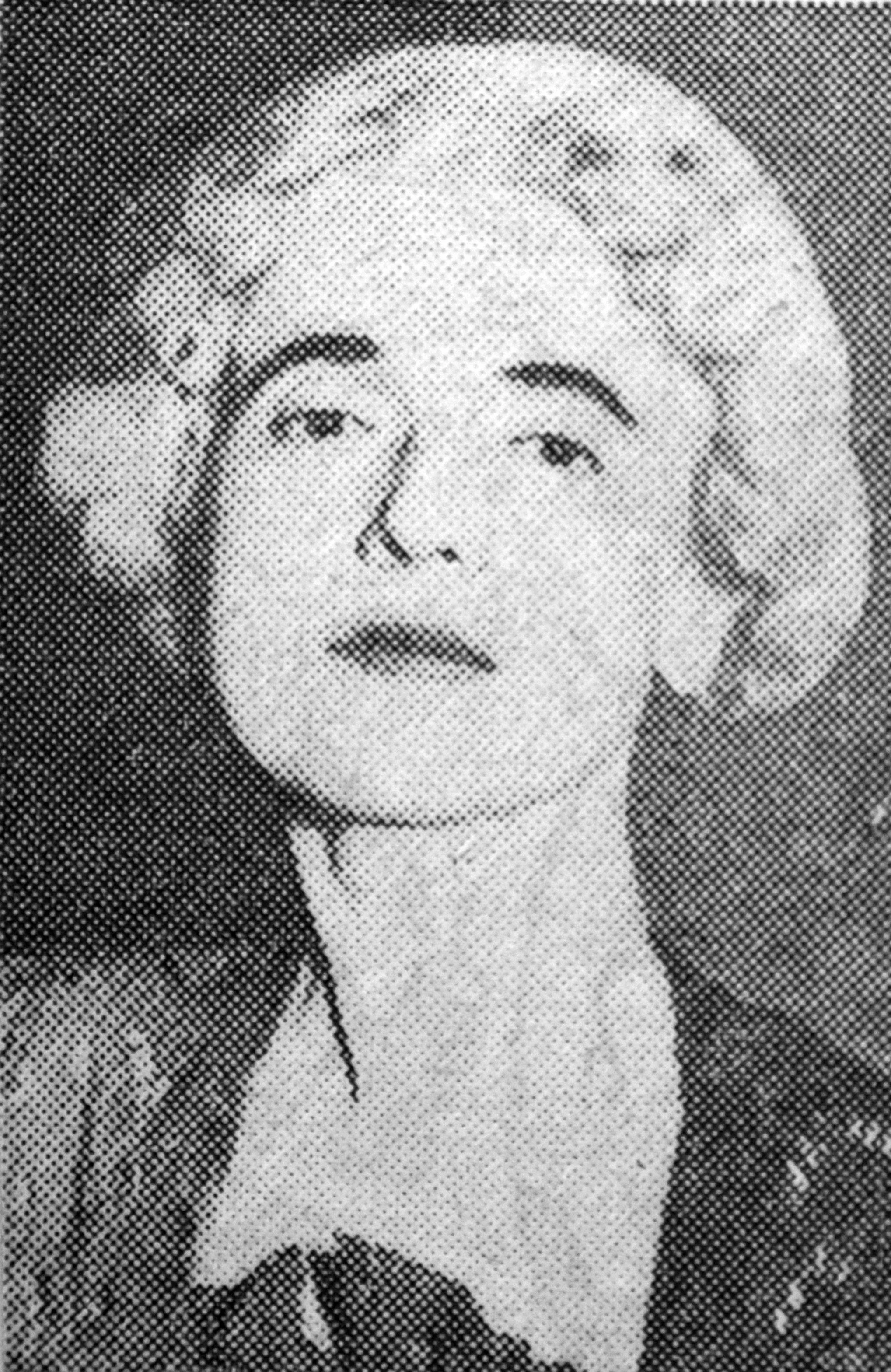
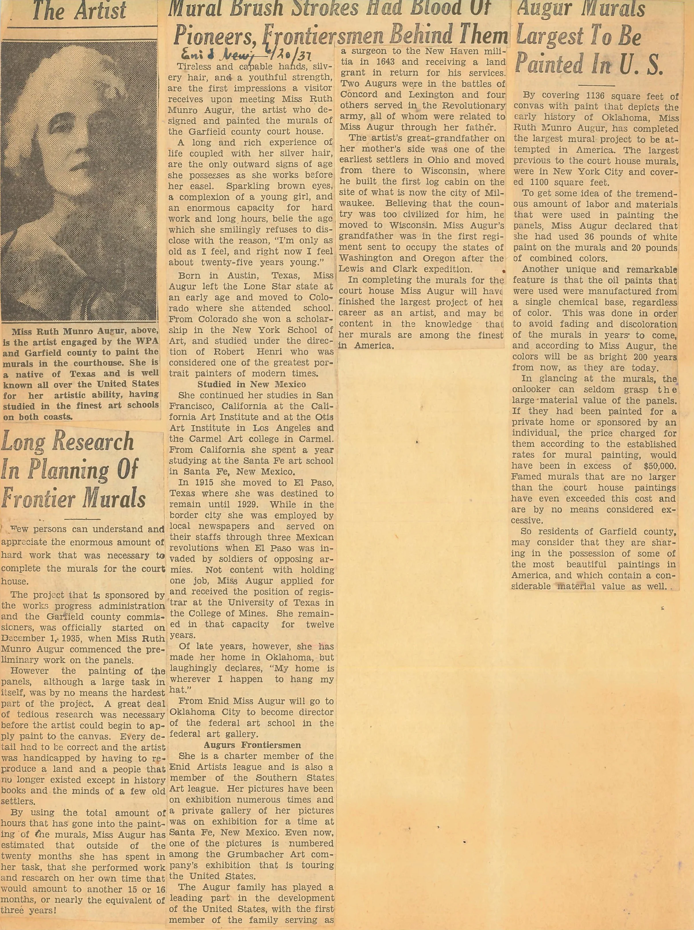
Ruth actively sought the contract for the Garfield County courthouse, recognizing, I believe, that it would bring national attention to her art. She was not wrong.
This contract was not something that was given out willy nilly, nor was it a hand out, you had to have the talent, drive, and expertise to pull off something as large as the courthouse project. Ruth submitted her work and ideas for the murals and won the commission, hands down.
Tulsa World Newspaper 1936:
She began her long research in order to paint historically accurate renditions of Coronado, Plains Indians, Cowboys on a Cattle Drive, Plains Transportation, Branding Camp, and the 1893 Land Rush. Ruth’s research amounted to the equivalent of about 16 months before she even put paint to canvas, and it was a total of three years before the project was completed.
Remember, the libraries and memories of old timers is what she had to work with, as well as historically accurate clothing, saddles, spurs, chaps, chuck wagon items, etc., that the Enid townsfolk had in their possession. No internet collections to browse. It was time well spent, as the all of the murals are historically accurate in even the smallest detail.
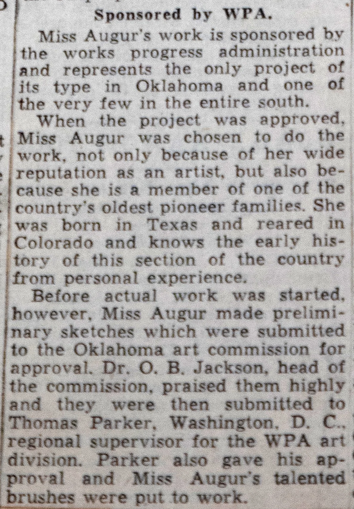
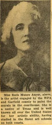
Ruth was paid $57.50 a month, about $1,400 in today’s money, for her research and painting. I’d say we all came out on the winning side in that transaction.
The facts and numbers have been copied/pasted numerous times; “The murals cover 1,136 square feet. To get some idea of the tremendous amount of labor and materials that were used in painting the murals, Miss Augur used 36 pounds of white paint on the murals and 20 pounds of combined colors.
Another unique and remarkable feature is the oil paints that were used were manufactured from a single chemical base, regardless of color. This was done in order to avoid fading and discoloration of the murals in years to come, and according to Miss Augur, the colors will be as bright 200 years from now as they are today.”
Yes, the colors are just as brilliant, albeit a good cleaning would not hurt. There was an attempt at cleaning the murals several years ago using elementary school children, sponges and water.
It is incredibly expensive to professionally clean works of art, and 25% of the proceeds from print sales will go to Garfield County to help in that cause.
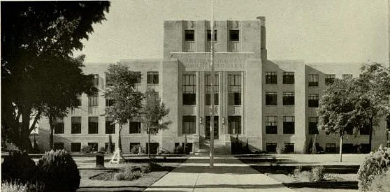
Ruth painted a total of 6 large murals inside the courthouse, all of which are still in their original places, as well as painting 4 ‘end panels’ describing the large murals on the 1st floor of the courthouse.
In about the middle part of 1936, Ruth had completed three of the murals; The Hunting Trail, The Explorer’s Trail, and The Cattle Trail.
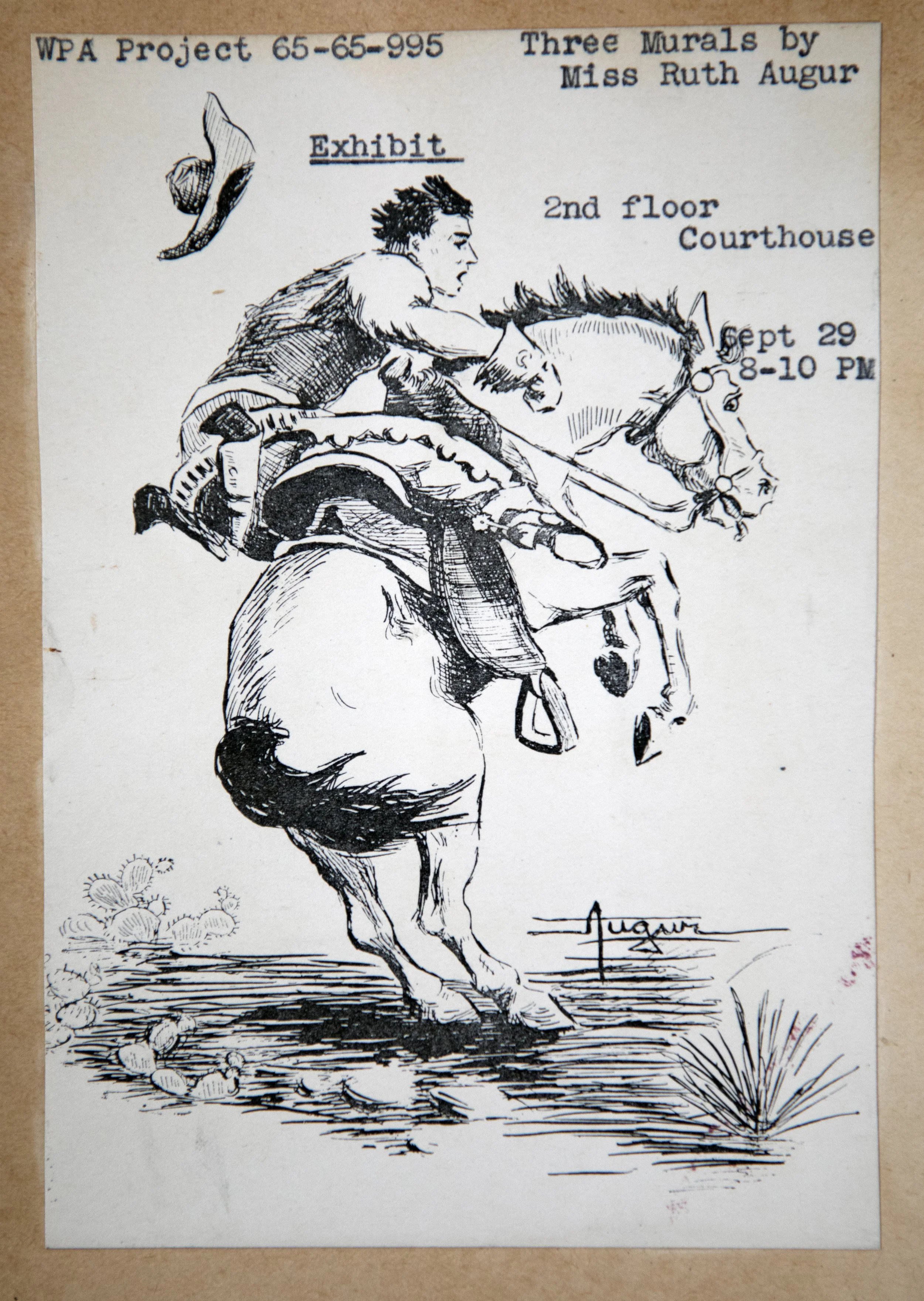
She designed and sketched her own invitation to the press and general public.
All of the text underneath the following murals, and adjacent to the end panels that Ruth painted, has been transcribed word by word from her hand painted sentences describing the story the murals are telling. If you look closely, you’ll see her brush strokes in the letters.
After all, who better to tell us the meaning behind them?

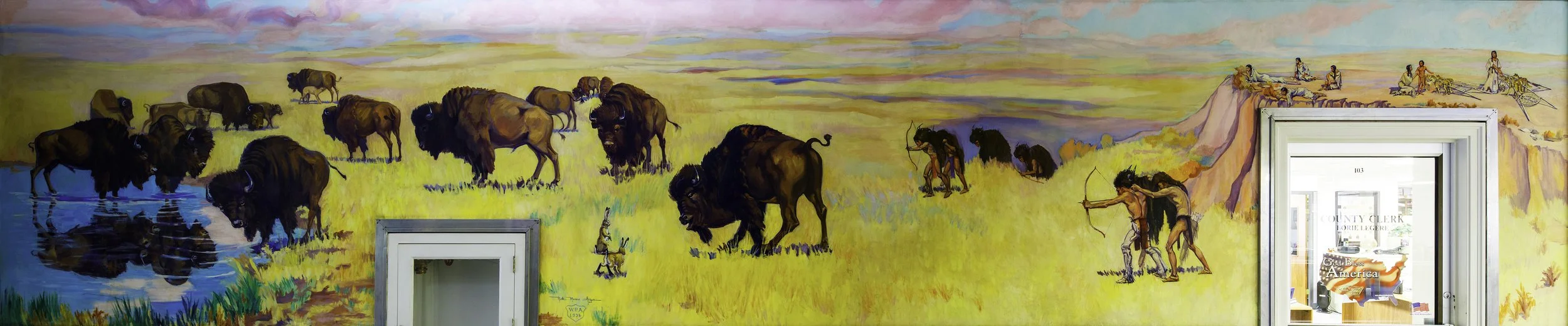
The Hunting Trail 26’ 9” wide x 6’ tall
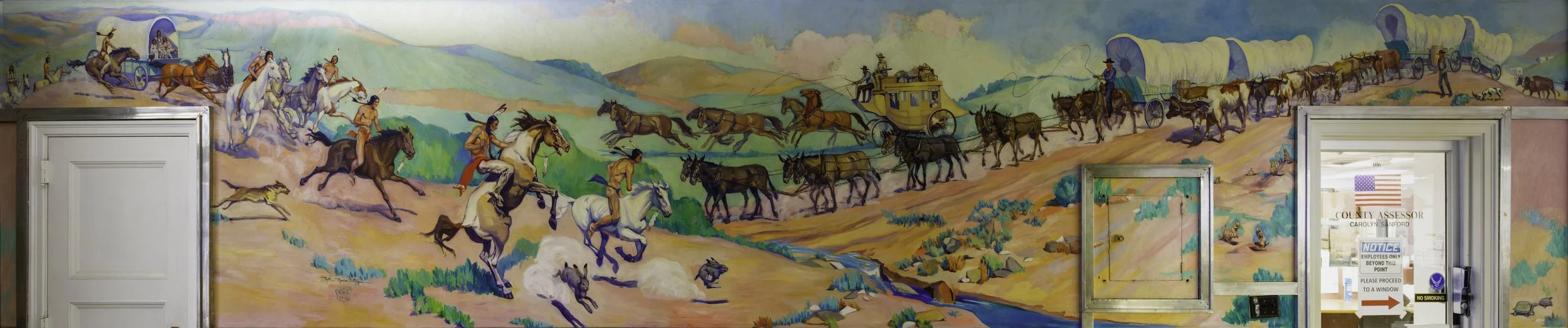
This is a scene on the Cherokee Strip in Oklahoma showing the hunting technique of the early Plains Indians.
No. 1, The Hunting Trail prior to 1541.
The Cherokee Strip was the hunting ground of many Indian tribes, whose main source of food was the buffalo. Indians learned that by covering themselves with buffalo skins they could approach within bow-shot, without alarming the buffalo, who were very large, very wild, and dangerous animals. Cabeya de Vaca, the first European to see the buffalo, described this method of hunting. There were no horses on the Western Hemisphere before the coming of the Spanish explorers. Indians stalked their game on foot, requiring courage, skill, and patience. They hunted for food only, never for sport. Hunts were preceded by religious ceremonials supplicating the Great Spirit for success, which meant food, clothing, robes for warmth, skins for tepi covering for shelter. The squaws on the distant bluff await the kill, to then do their part, to skin and dress the animals and load the meat on the dog travois for transportation back to the tribal camp. The Indians had bred a domesticated dog from wolf and coyote, to haul their heavier luggage, in earlier times, the squaw’s task.
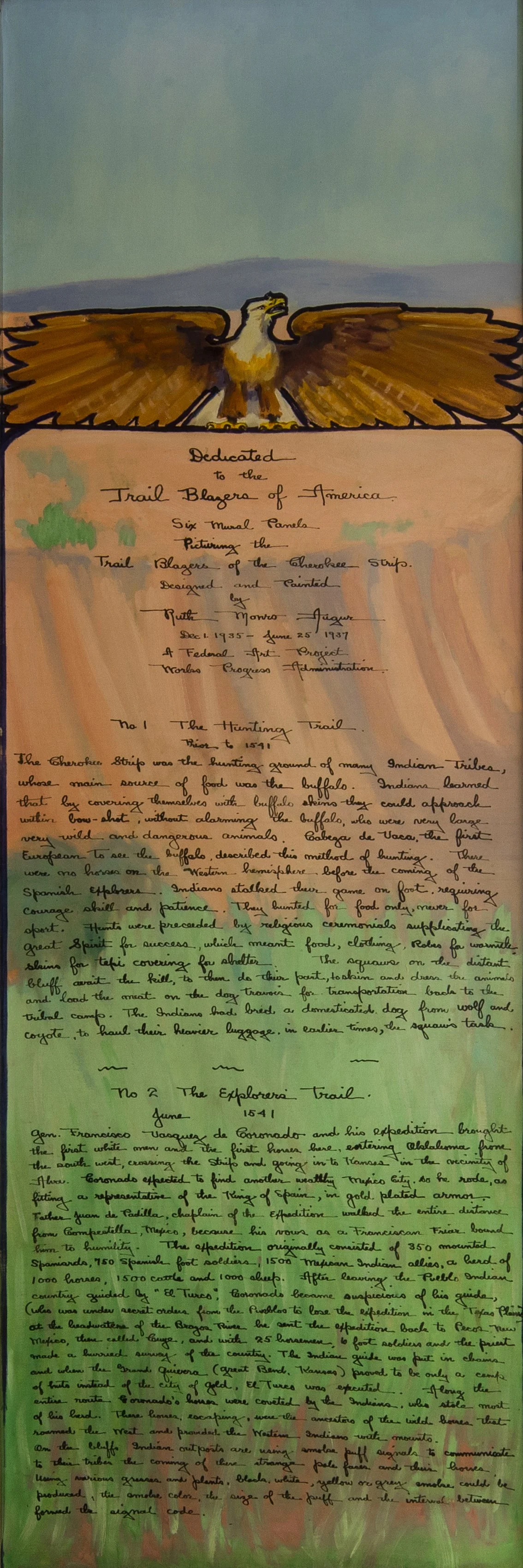
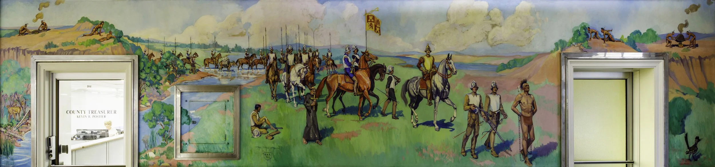
The Explorer’s Trail 26’ 9” wide x 6’ tall
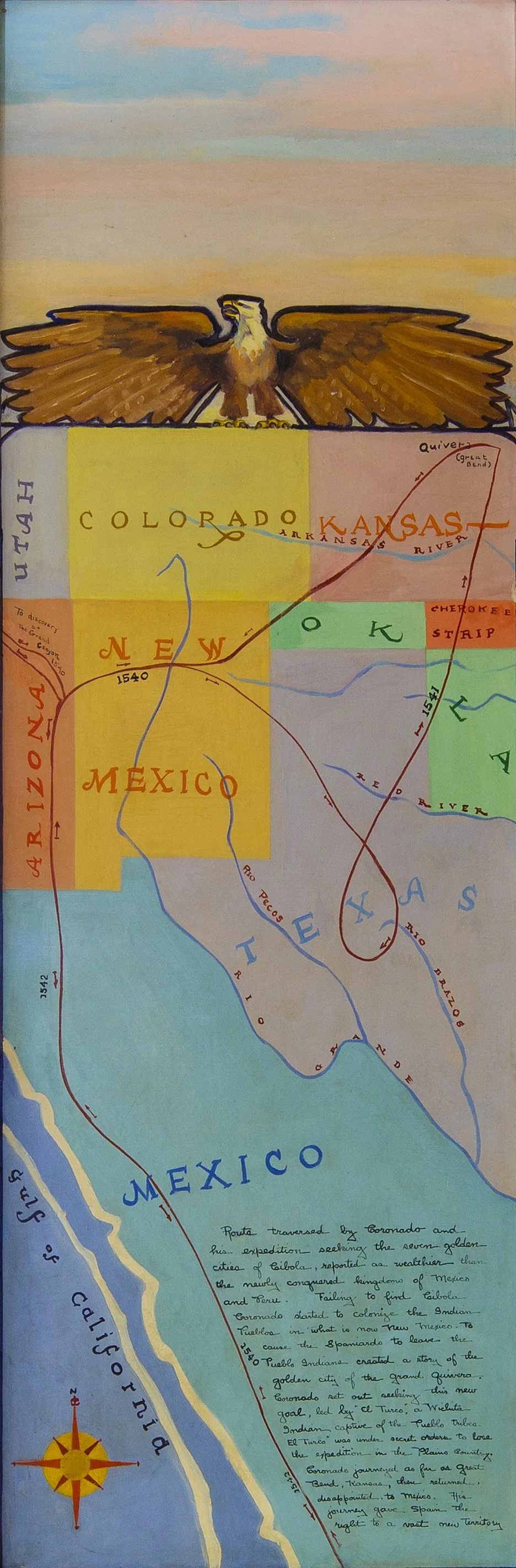
This scene is of Coronado’s expedition through what is now Oklahoma.
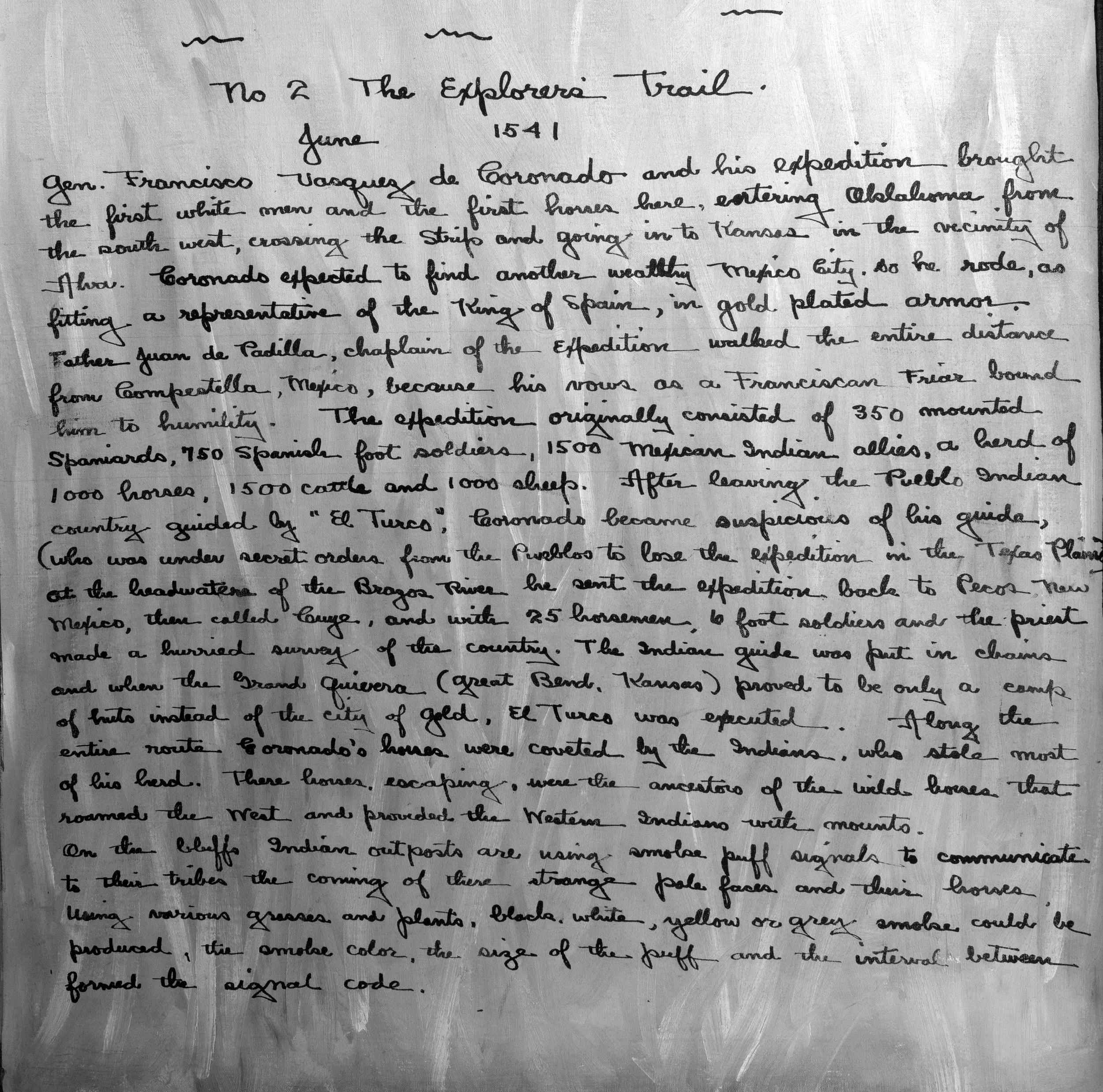
No 2 The Explorer’s Trail
June 1541
Gen. Francisco Vasquez de Coronado and his expedition brought the first white men and the first horses here, entering Oklahoma from the south west, crossing the Cherokee Strip and going into Kansas in the vicinity of Alva. Coronado expected to find another wealthy Mexico City, so he rode as fitting a representative of the King of Spain, in gold plated armor. Father Juan de Padilla, chaplain of the expedition, walked the entire distance from Compestilla, Mexico, because his vows as a Franciscan Friar bound him to humility. The expedition originally consisted of 350 mounted Spaniards, 750 Spanish foot soldiers, 1,500 Mexican Indian allies, a herd of 1,000 horses, 1,500 cattle, and 1,000 sheep. After leaving the Pueblo Indian country guided by “El Turco”, Coronado became suspicious of his guide, (who was under secret orders from the Pueblos to lose the expedition in the Texas Plains) at the headwater of the Braza River he sent the expedition back to Pecos, New Mexico, then called Guge, and with 25 horsemen, 10 foot soldiers and the priest made a hurried survey of the country. The Indian guide was put in chains and when the Grand Quivera (Great Bend, Kansas) proved to be only a camp of huts instead of the city of gold, El Turco was executed. Along the entire route Coronado’s horses were coveted by the Indians, who stole most of his herd. These horses, escaping, were the ancestors of the wild horses that roamed the west and provided the Western Indians with mounts. On the bluffs, Indian outposts are using smoke puff signals to communicate to their tribes the coming of the strange pale faces and their horses. Using various grasses and plants, black, white, yellow or grey smoke could be produced. The smoke color, the size of the puff, and the intervals between formed the signal code.

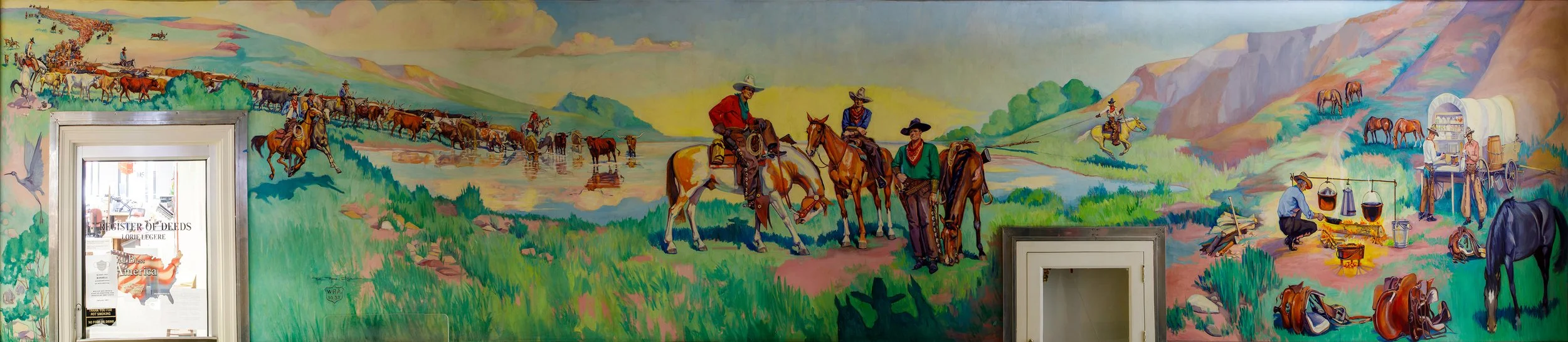
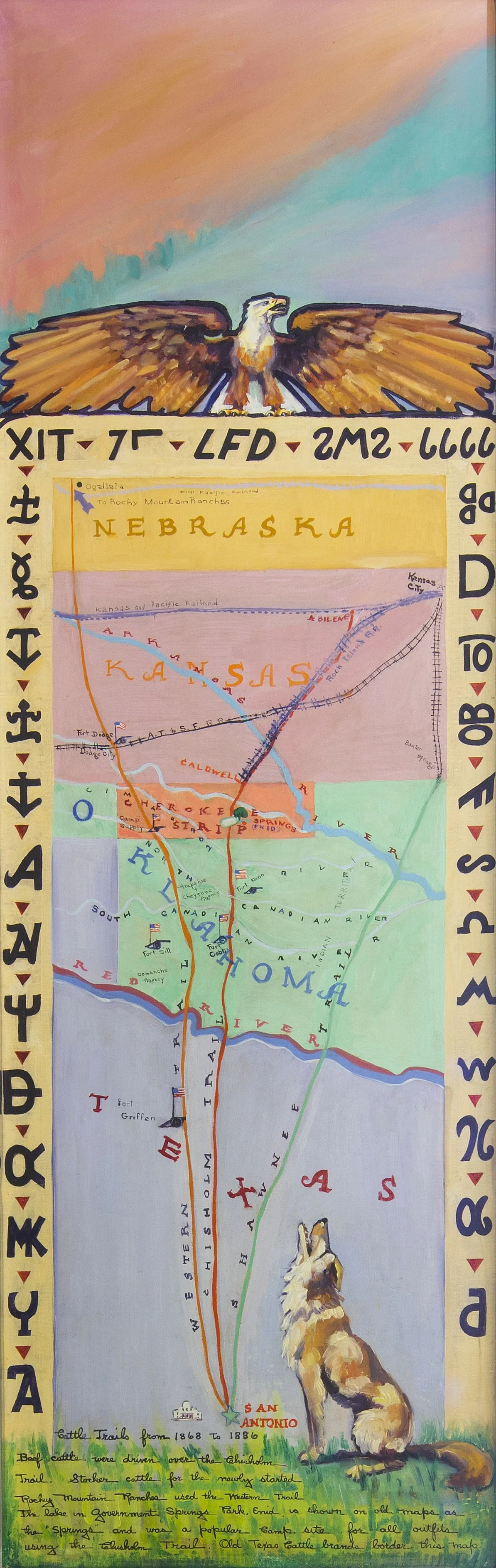
The Cattle Trails 29’ 5” wide x 6’ tall
This scene is a cattle drive at Government Springs, Enid, Oklahoma
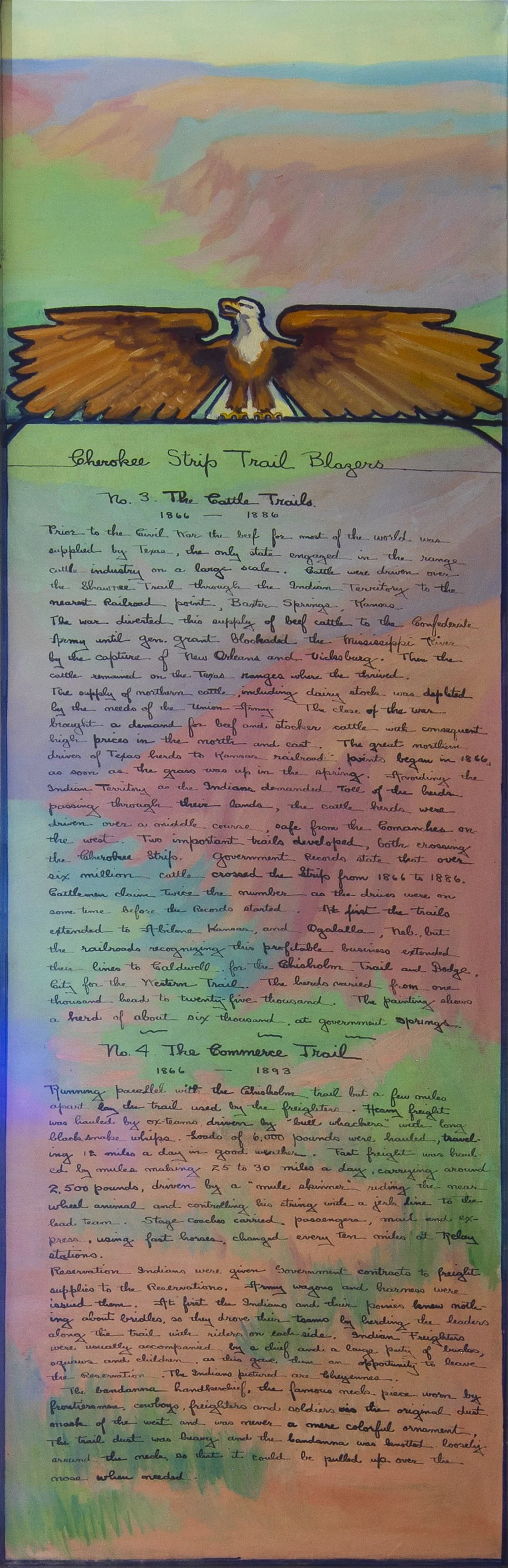
Cherokee Strip Trail Blazers
No. 3. The Cattle Trails.
1866-1886
Prior to the Civil War the beef for most of the world was supplied by Texas, the only state engaged in the range cattle industry on a large scale. Cattle were driven over the Shawnee Trail through the Indian Territory to the nearest railroad point, Baxter Springs, Kansas. The war diverted this supply of beef cattle to the confederate army until Gen. Grant Blockaded the Mississippi River by the capture of New Orleans and Vicksburg. Then the cattle remained on the Texas ranges where they thrived. The supply of northern cattle, including dairy stock, was depleted by the needs of the Union Army. The close of the war brought a demand for beef and stocker cattle with consequent high prices in the north and east. The great northern drives of Texas hers to Kansas railroad points began in 1866 as soon as the grass was up in the spring. Avoiding the Indian Territory as the Indians demanded toll of the hers passing through their lands, the cattle herds were driven over a middle course, safe from the Commanches on the west. Two important trails developed, both crossing the Cherokee Strip. Government records state that over six million cattle crossed the Strip from 1866-1886. Cattlemen claim twice the number as the drives were on some time before records started. At first the trails extended to Abilene, Kansas, and Ogalalla, Neb., but the railroads recognizing this profitable business, extended their lines Caldwell for the Chilholm Trail and Dodge City for the Western Trail. The herds varied from one thousand head to twenty-five thousand. The painting shows a herd of about six thousand at Government Springs.

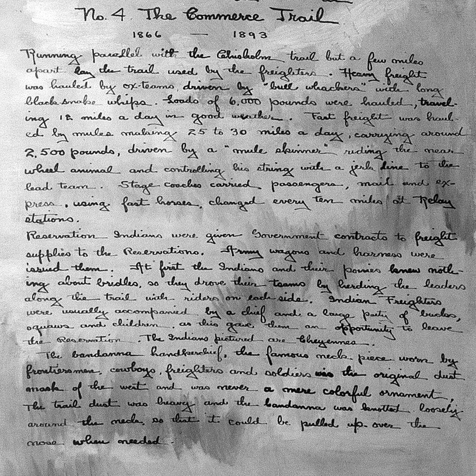
The Commerce Trail 29’ 7” wide x 6’ tall
This scene depicts moving supplies in the Cherokee Strip
No. 4. The Commerce Trail
1866-1893
Running Parallel with the Chisholm Trail, but a few miles apart, lay the trail used by the freighters. Heavy freight was hauled by ox-teams driven by “bull whackers’ with long, black-snake whips. Loads of 6,000 pounds were hauled, traveling 12 miles a day in good weather. Fast freight was hauled by mules making 25-30 miles a day, carrying around 2,500 pounds, driven by a “mule skinner” riding the rear wheel animal and controlling his string with a jerk line to the lead team. Stage coaches carried passengers, mail and express, using fast horses, changed every ten miles at realy stations.
Reservation Indians were given Government contracts to freight supplies to the Reservations. Army wagons and harness were issued them. At first the Indians and their ponies knew nothing about bridles, so they drove their teams by herding the leaders along the trail with ridgers on each side. Indian freighters were usually accompanied by a chief and a large party of bucks, squaws and children, as this gave them an opportunity to leave the Reservation. The Indians pictured are Cheyennes.
The bandana handkerchief, the famous neck piece worn by frontiersmen, cowboys, freighters, and soldiers, was the original dust mask of the west and was never a mere colorful ornament. The trail dust was heavy and the bandana was knotted loosely around the neck so that it could be pulled up over the nose when needed.
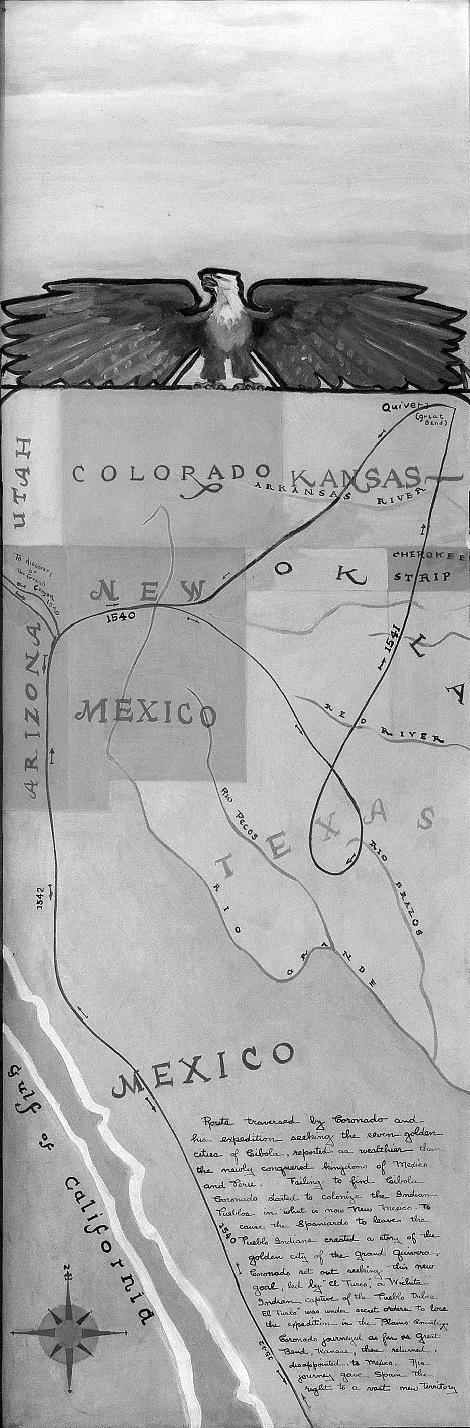
Route traversed by Coronado and his expedition of Cibola, reported as wealthier than the newly conquered kingdoms of Mexico and Peru. Failing to find Cibola, Coronado started to colonize the Indian Pueblos in what is now New Mexico. To cause the Spaniards to leave, the Pueblo Indians created a story of the golden city of the grand guivera. Coronado set out seeking this new goal, led by “El Turco”, a Wichita Indian captive of the Pueblo tribes. “El Turco” was under secret orders to lose the expedition in the Plains country. Coronado journeyed as far as Great Bend, Kansas, then returned, disappointed, to Mexico. His journey gave Spain the right to a vast new territory.
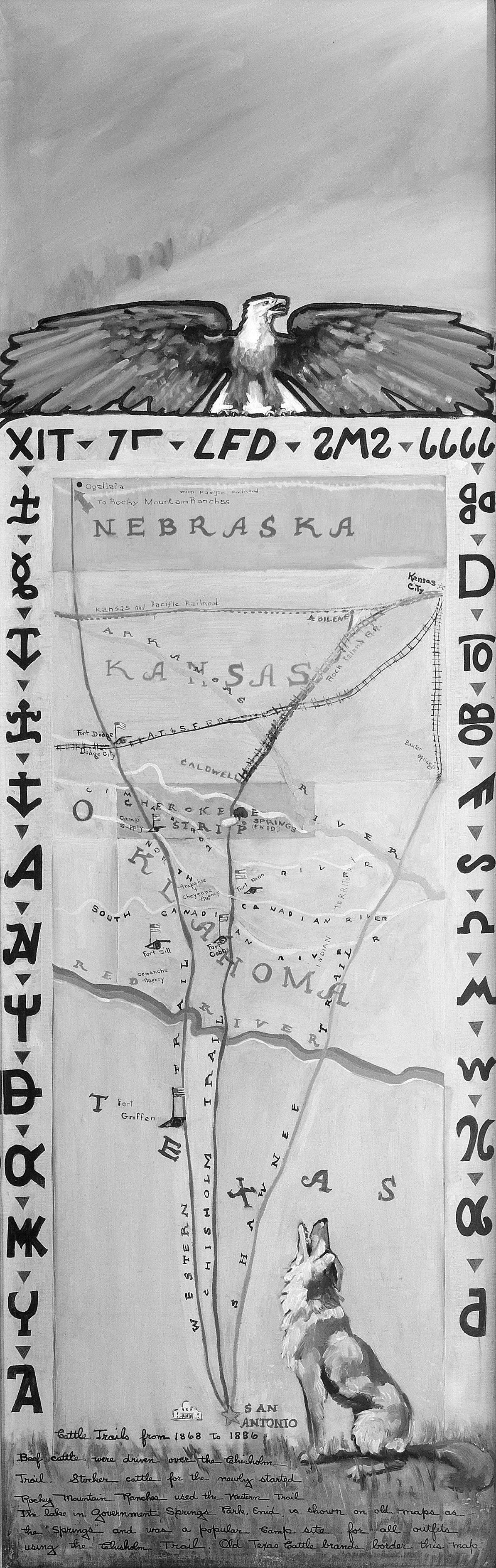
Cattle Trails from 1868 to 1886
Beef Cattle were driven over the Chisholm Trail. Stocker cattle for the newly started Rocky Mountain Ranches used the Western Trail. The lake in Government Springs Park, Enid, is shown on old maps as the “Springs” and was a popular camp site for all outfits using the Chisholm Trail. Old Texas cattle brands border this map.
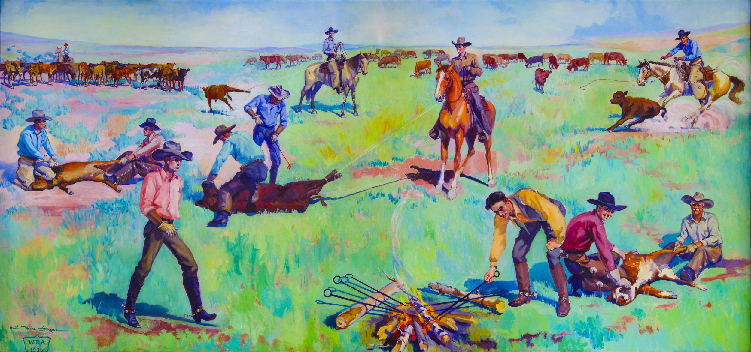
The Rancher’s Trail 10’ 2” wide x 5’ tall
This scene hangs on a wall of the second floor in the courthouse and shows the cowboys branding the newest members of the herd.
Notice the fellow in the lower right of the painting, he appears to be looking at Ruth as she painted this scene.
Many Enid residents posed for Ruth for her cowboys and other figures, and it makes me wonder if this fellow didn’t just have a great joke to tell her at the time. We’ve named him ‘Smiley’.
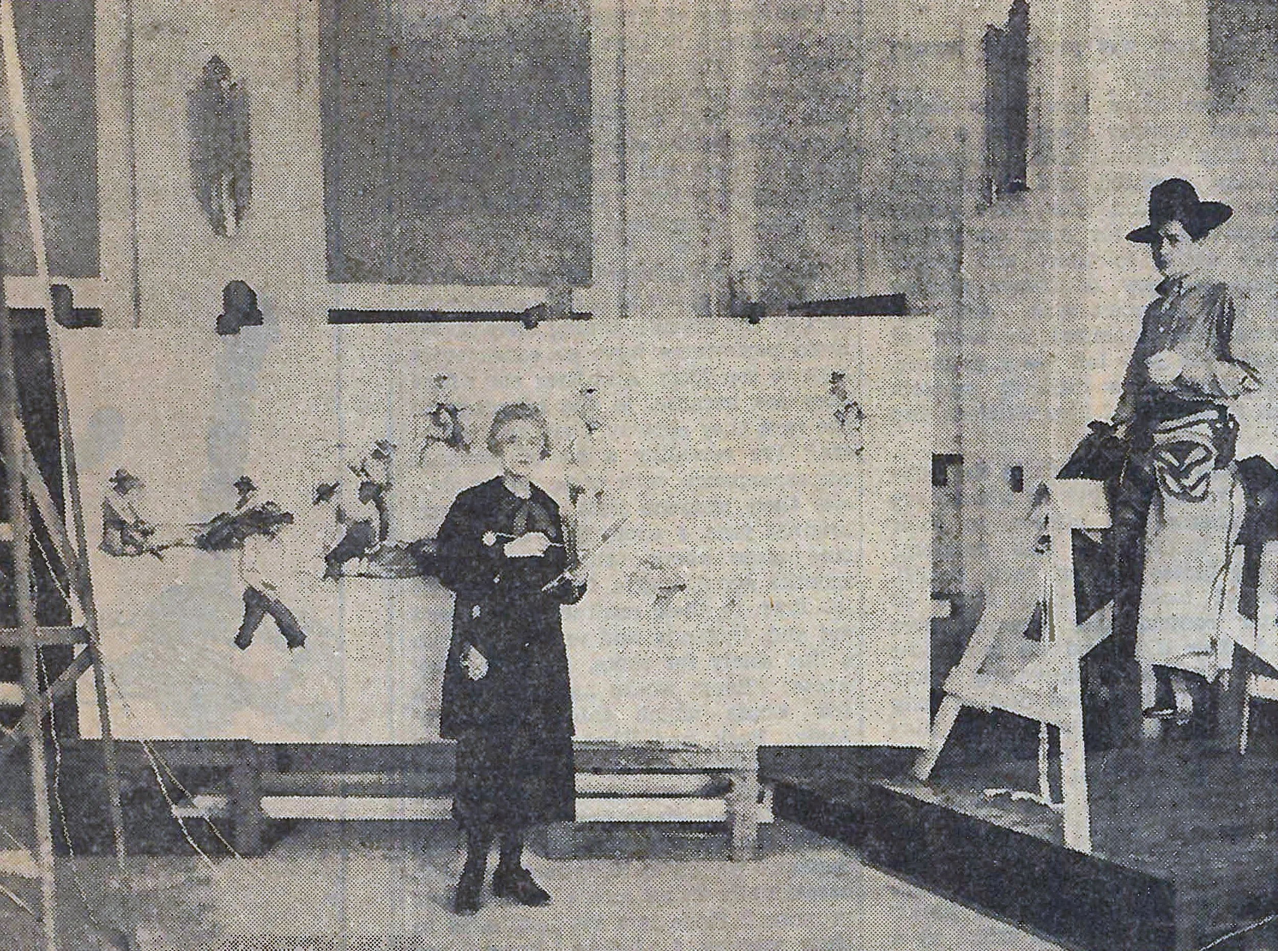
There is at least one photograph we have found in ‘The Oklahoman’ newspaper from 1936 that shows Ruth at work in her studio that occupied the second floor of the new courthouse. It shows an Enid resident on a saddle sitting on a saddle horse.

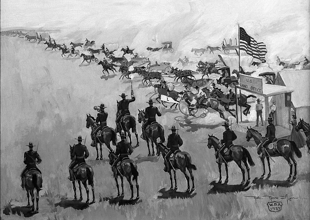
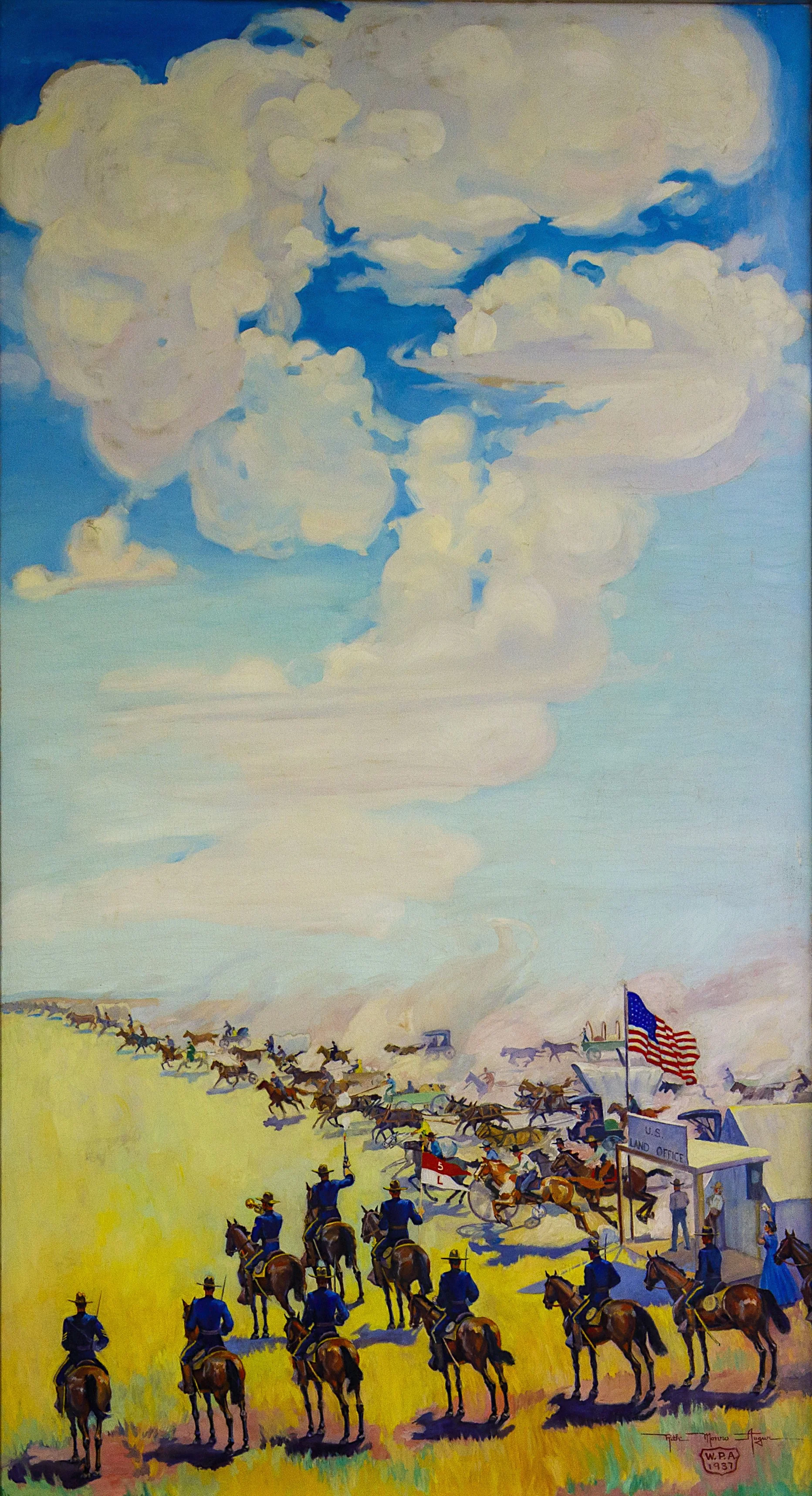
The Home Seeker’s Trail
10’ tall x 5’ 9.5” wide
This hangs on a wall in the stairwell landing between the first and second floor of the courthouse.
Depicting the 1893 Land Rush after the Cherokee Strip had been purchased from the Indians and opened for settlers.
Miss Augur painted her heart out for 16 months after exhaustive research which came to about the same amount of time paint hit the canvas. Just about three years. No internet, no computer.
What she did have were a people who had lived through the Land Rush of 1893, cowboys who had ridden the Chisholm Trail, Wagon Masters, cooks who handled the Chuck Wagon, stories handed down through families, authentic chaps, spurs, cooking utensils, coffee pouches, and the cooperation of the entire town of Enid, Oklahoma.
Residents readily brought their cherished keepsakes for Ruth to paint into history, as well as their friends and relatives.
E. G. ‘Parson’ Barnard, a cattle trail cook in the early days, checked the Chuck Wagon and its supplies. 100% authentic for the period.
W. R. Ingram of Healdton, Oklahoma, father of Mrs. Carl Ford of Enid, who drove a stage coach route between Paul’s Valley, Oklahoma, and Fort Sill, Oklahoma, in 1879, checked all the harness portrayed. 100% Authentic for the period.
The Texas cattle brands bordering the Cattle Trails were selected by the University of Texas for use as the most representative of Texas cattle barons. George Rainey supplied the 1883 registered brand book of the Cherokee Strip Livestock Association.
The buffalo were sketched at the Knox Ranch near Covington, Oklahoma, thanks to the courtesy of the ranch owner, Charles Knox. The longhorn steers are from the herd that was at the Wichita Mountains Wild Life Refuge, with the cooperation of the US Forestry Service.
The names of the horses that were used as models are; Silver, Seven-Up, Mary, Buster, Choctaw, Don, and Prince.
This is just the tip of the iceberg when it comes to the town, and region, pulling together to ensure the historical accuracy in the murals. Leather chaps, old boots, whips, you name it and they were sketched by Ruth and painted into the scenes.
Army officers checked the uniforms and equipment in ‘The Home Seeker’s Trail’ and gave their nod of approval as being in line with existing War Department regulations of that time.
I found a paragraph in the ‘Enid News’ from June of 1937 that pretty much sums it up.
Majestic in their sweep, bold in their coloring, and seemingly endowed with life by the artists brush, the paintings hold fast on their canvas, a generation and a people that are rapidly passing on.